
繁體中文
葵青區包含葵涌與青衣,是貨櫃港及物流設施的主要所在地,同時有大型公共屋邨及新市鎮住宅。青衣以橋樑連接荃灣及市區。
主要地方(非完整地名錄):葵涌、青衣、葵芳、大窩口。
新界 / New Territories · 地區號碼 S
Kwai Tsing
全港十八區嘅 JSONOpenAPI 3.1All 18 districts as JSON · /api/v1/districts.json · 路徑由端點登記冊派生
繁體中文
葵青區包含葵涌與青衣,是貨櫃港及物流設施的主要所在地,同時有大型公共屋邨及新市鎮住宅。青衣以橋樑連接荃灣及市區。
主要地方(非完整地名錄):葵涌、青衣、葵芳、大窩口。
English
Kwai Tsing comprises Kwai Chung and Tsing Yi. It is a principal location for the container port and logistics facilities, and also contains large public housing estates. Tsing Yi is linked by bridges to Tsuen Wan and the urban area.
Principal localities (not a complete gazetteer): Kwai Chung, Tsing Yi, Kwai Fong, Tai Wo Hau.
繁體中文
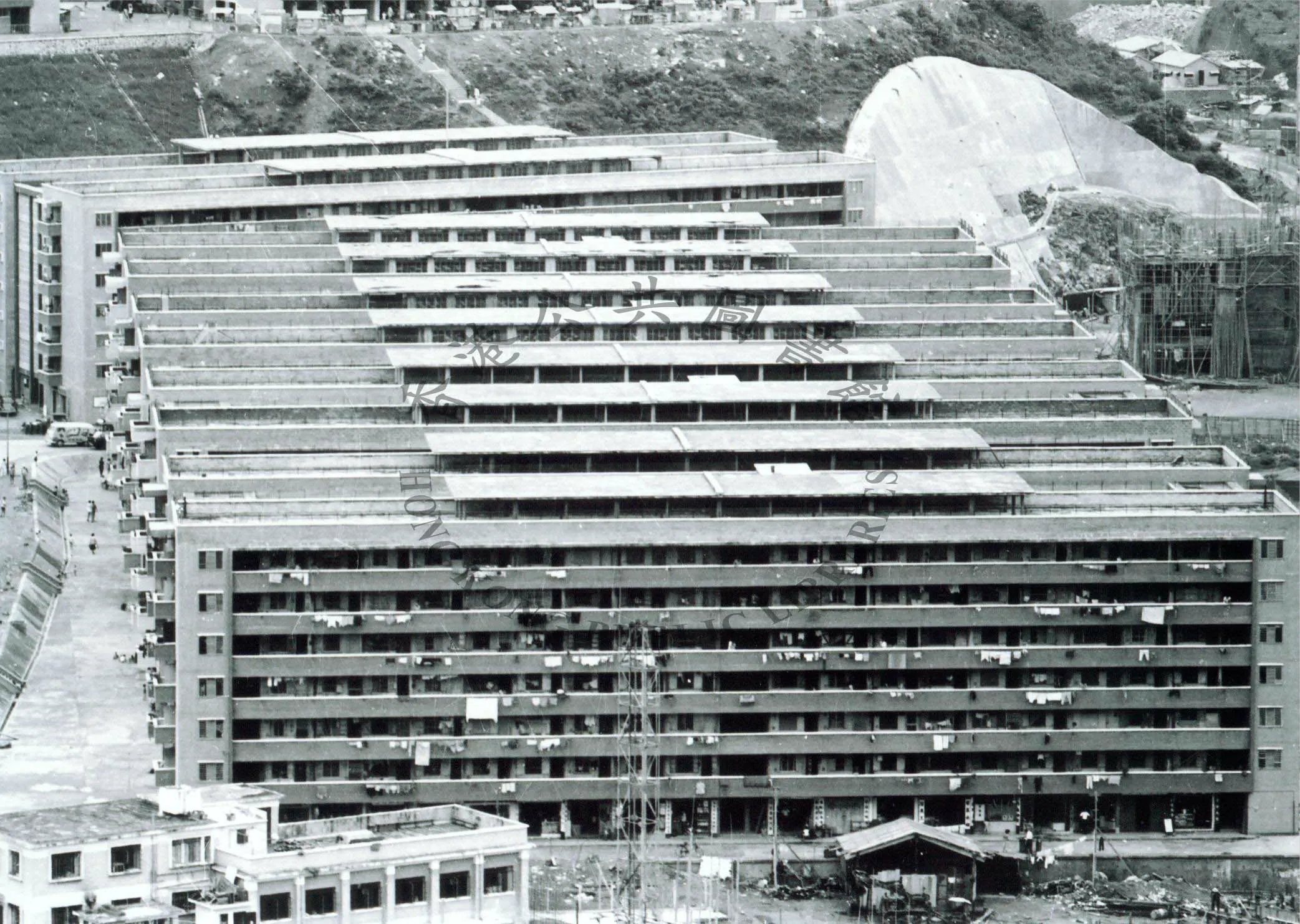
葵青區位於新界西南部,包括葵涌、青衣及大窩口,是香港島與九龍以外人口最密集的地區之一。青衣島以橋樑連接葵涌及荃灣,藍巴勒海峽分隔葵涌與青衣。
English
Kwai Tsing lies in the south-west New Territories, comprising Kwai Chung, Tsing Yi and Tai Wo Hau. It is one of the most densely populated districts outside the island and Kowloon. Tsing Yi is linked to Kwai Chung and Tsuen Wan by bridges across Rambler Channel.
繁體中文
葵青發展始於 1960 年代葵涌貨櫃碼頭動工,1970 年代起成為全球其中一個最繁忙的貨櫃港。青衣 1970 年代發展為大型工業及住宅島。大窩口是早期徙置區之一。現時青馬大橋及汲水門大橋的九龍方向落腳點位於青衣。青衣島古稱「春花落」,明代已有漁民聚居,島上出土新石器時代至漢代文物;青衣墟原是島上傳統墟市。葵涌原為上葵涌、下葵涌等客家村落與農地,1960年代末政府選址建貨櫃碼頭,1972年首個碼頭啟用,標誌香港轉為國際航運中心。
English
Kwai Tsing grew with the construction of the Kwai Chung Container Terminals from the 1960s, becoming one of the world’s busiest container ports in the 1970s. Tsing Yi developed from the 1970s into a major industrial and residential island. Tai Wo Hau was one of the earliest resettlement areas. The Tsing Ma Bridge and Kap Shui Mun Bridge land on Tsing Yi on their Kowloon side. Tsing Yi was known anciently as "Chun Fa Lok" and settled by fishermen from the Ming dynasty; Neolithic-to-Han artefacts have been found on the island, and Tsing Yi Hui was its traditional market. Kwai Chung was formerly Hakka villages and farmland; from the late 1960s the Government built container terminals here, the first opening in 1972, marking Hong Kong's rise as a world shipping hub.
非完整名單;標示「部分」者代表並非全數位於本區。
繁體中文
港鐵荃灣線經大窩口、葵興、葵芳站;東涌線設荔景站;東涌線及機場快線經青衣站,青衣站是機場快線唯一市區中途站。葵青貨櫃碼頭由貨櫃碼頭路及葵青路連接。
English
The Tsuen Wan Line serves Tai Wo Hau, Kwai Hing and Kwai Fong; the Tung Chung Line stops at Lai King; the Tung Chung Line and Airport Express run through Tsing Yi station, the only Airport Express stop before the airport. The container terminals are served by Container Port Road and Kwai Tsing Road.
非完整地名錄。
繁體中文
葵青貨櫃碼頭是全球主要港口設施,與青衣南部的工業區共同構成香港物流及港口核心。葵涌一帶有大量工廈活化作辦公室及貨倉用途。青衣有多個大型商場及住宅發展。
English
The Kwai Tsing Container Terminals, together with the southern Tsing Yi industrial area, form the core of Hong Kong’s port and logistics economy. Kwai Chung retains extensive industrial buildings, many converted for offices and warehousing. Tsing Yi hosts large malls and substantial residential development.
港鐵站、公立醫院、博物館、公共圖書館及大學名錄來自本站名錄頁,全部可核對。
教育局官方名錄:本區共 140 間學校(幼稚園 63、小學 38、中學 39), 其中 61 間(小學/中學)喺官方概覽有校長姓名;幼稚園校長姓名本站未取用。
面積、人口密度、教育程度及房屋類型分佈。全港比較數字列於括號內。
| 項目 / Item | 本區 / This district | 全港 / Territory |
|---|---|---|
| 土地面積 Land area | 21.9 平方公里 | 1,114.6 平方公里 |
| 人口密度 Population density | 22,142 人/平方公里 | 6,870 人/平方公里 |
| 學位程度人口 Degree or above (15+) | 24.8% | 27.6% |
| 房屋類型 Housing type | 公屋 42.6% · 資助出售 13.5% · 私人 43.9% | 公屋 28.2% · 資助出售 15% · 私人 56.7% |
| 平均住戶人數 Average household size | 2.5 人 | 2.5 人 |
| 自置居所比率 Home ownership | 55.8% | 60.1% |
由《香港紀事館·大事記》按「地方」反查——輸入地名即出該處的官方一手大事(時間+空間雙軸)。 每條附一手來源,全部可核對。
呢一段用同大事記、志錄年份頁完全一樣嘅條目卡: 每條有固定錨點(id="EV-…")同「引用呢條」按鈕,引文由已登記來源派生,唔會另外手寫一份。 覆蓋範圍只限已核大事(志錄條目本身冇逐條區議會分區歸屬,見 來源譜系)。 These entries use the same card as the milestone and year pages, with a stable anchor and an inline citation; coverage stops at checked milestones, because archive entries carry no per-entry district.
引用每條都可以引用:按條目下面嘅「引用呢條」,可以揀中文腳註/中文參考書目/APA/Chicago 四種格式並複製。 書名、出版者、年份同頁碼一律由已登記來源同生成檔派生,頁面一條都唔會手寫;年份取來源登記嘅出版年, 來源未登記出版年嘅,引文改用查閱日期並寫明。
Every entry is citable. Press “Cite this entry” for a Chinese footnote, Chinese bibliography, APA or Chicago note — all derived from the registered source and the generated archive, never hand-written. If a registered source has no publication year, the citation prints the access date and says so.
香港海事處:香港港口史第1部第7章(葵涌貨櫃碼頭一號1972年完成) Marine Dept: History of Port of HK Part 1 Ch.7 (CT1 completed 1972)
中文腳註香港海事處,香港海事處:香港港口史第1部第7章(葵涌貨櫃碼頭一號1972年完成)(查閱日期 2026-10-11),頁 〈頁碼〉,/districts/kwai-tsing#〈條目編號〉。
APAMarine Department. Marine Dept: History of Port of HK Part 1 Ch.7 (CT1 completed 1972) (p. 〈頁碼〉). Accessed 2026-10-11. /districts/kwai-tsing#〈條目編號〉
路政署:新界道路(青衣大橋1974年落成) Highways Dept: Roads in the New Territories (Tsing Yi Bridge 1974)
中文腳註路政署,路政署:新界道路(青衣大橋1974年落成)(查閱日期 2026-10-11),頁 〈頁碼〉,/districts/kwai-tsing#〈條目編號〉。
APAHighways Department. Highways Dept: Roads in the New Territories (Tsing Yi Bridge 1974) (p. 〈頁碼〉). Accessed 2026-10-11. /districts/kwai-tsing#〈條目編號〉
醫院管理局九龍西聯網:瑪嘉烈醫院 HA Kowloon West Cluster: Princess Margaret Hospital
中文腳註醫院管理局,醫院管理局九龍西聯網:瑪嘉烈醫院(查閱日期 2026-10-11),頁 〈頁碼〉,/districts/kwai-tsing#〈條目編號〉。
APAHospital Authority. HA Kowloon West Cluster: Princess Margaret Hospital (p. 〈頁碼〉). Accessed 2026-10-11. /districts/kwai-tsing#〈條目編號〉
港鐵公司年報:荃灣線1982年5月10日通車(葵興、葵芳站啟用) MTR annual report: Tsuen Wan Line opens 10 May 1982
中文腳註香港鐵路有限公司,港鐵公司年報:荃灣線1982年5月10日通車(葵興、葵芳站啟用)(查閱日期 2026-10-11),頁 〈頁碼〉,/districts/kwai-tsing#〈條目編號〉。
APAMTR Corporation. MTR annual report: Tsuen Wan Line opens 10 May 1982 (p. 〈頁碼〉). Accessed 2026-10-11. /districts/kwai-tsing#〈條目編號〉
路政署Fact Sheet:青馬大橋 HyD Fact Sheet: Tsing Ma Bridge
中文腳註路政署,路政署Fact Sheet:青馬大橋(查閱日期 2026-10-11),頁 〈頁碼〉,/districts/kwai-tsing#〈條目編號〉。
APAHighways Department. HyD Fact Sheet: Tsing Ma Bridge (p. 〈頁碼〉). Accessed 2026-10-11. /districts/kwai-tsing#〈條目編號〉
康文署:葵青劇院 LCSD: Kwai Tsing Theatre
中文腳註康樂及文化事務署,康文署:葵青劇院(查閱日期 2026-10-12),頁 〈頁碼〉,/districts/kwai-tsing#〈條目編號〉。
APALeisure and Cultural Services Department. LCSD: Kwai Tsing Theatre (p. 〈頁碼〉). Accessed 2026-10-12. /districts/kwai-tsing#〈條目編號〉
路政署Fact Sheet:昂船洲大橋 HyD Fact Sheet: Stonecutters Bridge
中文腳註路政署,路政署Fact Sheet:昂船洲大橋(查閱日期 2026-10-11),頁 〈頁碼〉,/districts/kwai-tsing#〈條目編號〉。
APAHighways Department. HyD Fact Sheet: Stonecutters Bridge (p. 〈頁碼〉). Accessed 2026-10-11. /districts/kwai-tsing#〈條目編號〉
Substitute the entry’s page number and ID (shown as 〈頁碼〉/〈條目編號〉) into the pattern above. The same templates, plus rules and limits, are in the citation block of /api/v1/archive.json.
1972 · 葵青區 · 香港海事處只記「1972年」完成,具體啟用日未能核實。
Container Terminal No.1 opens, Hong Kong's first dedicated container terminal.
來源 香港海事處:香港港口史第1部第7章(葵涌貨櫃碼頭一號1972年完成)(香港海事處)
1974 · 葵青區 · 路政署只記「1974年」落成,具體通車日未能核實。
Tsing Yi Bridge is completed, the island's first road bridge linking it to Kwai Chung and Tsuen Wan.
來源 路政署:新界道路(青衣大橋1974年落成)(路政署)
1975 · 葵青 · 年級(醫院管理局官方記瑪嘉烈醫院成立於1975年)。
Princess Margaret Hospital is established in 1975, a key hospital and infectious-disease centre of the Kowloon West cluster.
來源 醫院管理局九龍西聯網:瑪嘉烈醫院(醫院管理局)
1982-05-10 · 葵青區
The MTR Tsuen Wan Line opens with the Kwai Hing and Kwai Fong stations.
來源 港鐵公司年報:荃灣線1982年5月10日通車(葵興、葵芳站啟用)(香港鐵路有限公司)
1997-05 · 青衣(青嶼幹線) · 路政署官方Fact Sheet記「1997年5月」通車,月級(青嶼幹線正式啟用另有開幕日正式啟用)。
The Lantau Link (including the Tsing Ma Bridge) opens, connecting Lantau to the urban area ahead of the new airport.
來源 路政署Fact Sheet:青馬大橋(路政署)
1997-05-22 · 青衣/馬灣(青嶼幹線) · 日級(運輸署記青嶼幹線1997年5月22日通車)。
The Tsing Ma Bridge opens as part of the Lantau Link, one of the world's longest dual road-and-rail suspension bridges connecting the New Territories and Lantau.
來源 路政署Fact Sheet:青馬大橋(路政署)
1999-11 · 葵青(葵青區) · 月級(康文署官方場地資料記1999年11月開幕)。
Kwai Tsing Theatre opens in November 1999, featuring one of the LCSD's first black box theatres.
來源 康文署:葵青劇院(康樂及文化事務署)
2009-12 · 葵青(昂船洲大橋,八號幹線) · 路政署官方Fact Sheet記「2009年12月」通車,月級。
Stonecutters Bridge opens — a cable-stayed bridge of 1,018-metre main span linking Tsing Yi and West Kowloon.
來源 路政署Fact Sheet:昂船洲大橋(路政署)
全部大事記(時間軸) · 按題目 · 全文檢索
政府統計處 2025 年年中土地人口(本站 fact 引用,全部可核對)。
| 項目 / Item | 數字 / Figure | 時點 / As of | 來源 / Source |
|---|---|---|---|
| 葵青區人口(2025年年中) Kwai Tsing population (mid-2025) | 494,500 494,500 政府統計處 2025 年年中土地人口。 | 2025 | 按區議會分區劃分的人口及住戶統計數字 2025年版 |
| 項目 / Item | 數字 / Figure | 時點 / As of |
|---|---|---|
| 陸上非住院人口 Land-based non-institutional population | 484 900 男 226 400/女 258 500 | 2025 |
| 年齡中位數 Median age | 49 歲 / years | 2025 |
| 性別比率 Sex ratio | 每千名女性對 876 名男性 | 2025 |
| 年齡結構 Age structure | 0–14: 9% · 15–24: 8% · 25–64: 57.7% · ≥65: 25.3% | 2025 |
| 勞動人口 Labour force | 236 300 勞動人口參與率 53.5% | 2025 |
| 家庭住戶 Domestic households | 180 400 戶 從事經濟活動 136 700/非從事經濟活動 43 700 | 2025 |
| 住戶每月入息中位數 Median monthly household income | 所有住戶 $25,700 從事經濟活動住戶 $34,000 | 2025 |
來源:按區議會分區劃分的人口及住戶統計數字 2025年版。原表以千人計,本站換算為人;因四捨五入,分區加總未必等於全港。此口徑是陸上非住院人口,不是年中人口估計。
開放時段與派籌規則以場地專頁為準,核對日期見該頁。
Auto Chat
只從已核對條目作答,不發明數字。
