Long-form / 深度專題
填海:由文咸東街到 70.27 平方公里
Reclamation: from Bonham Strand to 70.27 square kilometres
香港嘅海岸線,點解會變成可以不斷重畫嘅土地?
1852 年,政府用上環火災後嘅碎磚瓦填出文咸東街;1889 年中環填海要等到 1903 年才完成。由 1887 年到 2017 年,香港靠填海取得 70.27 平方公里土地。呢個數字背後,係一套把海港當成土地儲備嘅治理方式,也是一場未停止嘅公共爭議。
約 4 分鐘 · 6 節 · 13 條時間線 · 5 份文獻
English
1. 1852–1903: reclamation begins with sanitation and commerce
Hong Kong’s first official reclamation did not begin with a grand plan but with the leftovers of a fire. In 1852 the Government used broken bricks and tiles from the 1851 Lower Market fire, together with hillside stone, to fill the area near today’s Jervois and Morrison streets, naming the new shoreline Bonham Strand. Early reclamation was practical land assembly: materials nearby, limited scale, and the immediate goal of usable streets and buildings.
By 1889 the problem had changed. Silt along the waterfront prevented deep-water piers from operating, and commercial land on the northern shore was short. On 11 May the Government enacted an ordinance for the Central reclamation, which was completed only in 1903. Between 1852 and 1903 reclamation moved from disposing of fire debris to remaking the commercial centre. Once the shoreline moved, streets, leases, piers and drainage all had to follow; reclamation was never merely adding area.
2. 1921–1968: Wan Chai, Central and the four post-war phases
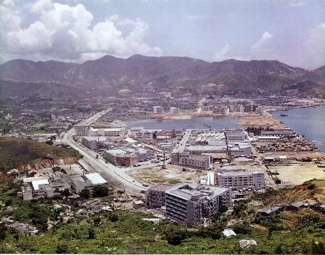
In September 1921 reclamation began along the Wan Chai waterfront and was completed in 1930. Some of the fill came from levelling Morrison Hill — taking a hill to make land. By 1931, 8,321 people had moved into the Wan Chai East area. The figure is a reminder that reclaimed land is not blank space for long: people soon live and trade there, while the original hill, shore and villages disappear.
Post-war reclamation in Central began on 24 November 1952 and ran in four phases: the first finished in August 1955, the last only in January 1968. The timeline shows that reclamation is not a single act of making land but years of engineering, traffic diversion, pier relocation and land leases. Each phase moved the shoreline for the next, making the “original waterfront” increasingly hard to trace.
3. 1990–2003: West Kowloon and the airport core programme
On 25 September 1990 the West Kowloon reclamation began, with the new Yau Ma Tei typhoon shelter as its first construction item. The order matters: shelter for vessels first, large-scale land-making second. The project reclaimed 340 hectares along the coast from Yau Ma Tei to Lai Chi Kok — the largest urban reclamation of its kind in the record — and was completed in 2003.
West Kowloon was not only housing or commercial land; it was the land base for the airport core programme and the West Kowloon transport corridor. Reclamation pushed the shoreline out and bought space for roads, rail, a typhoon shelter and new development. The cost was the burial of seabed, coastal ecology and water-based activity. Between 1990 and 2003 the new land moved from drawings into everyday city, while the argument over how much harbour should be reclaimed accumulated.
4. 2003–2007: judicial review, piers and heritage
In 2003 the Society for Protection of the Harbour initiated judicial review of Central Reclamation Phase III. The works began on 28 February that year; on 28 September the Government announced they would be suspended until the court ruled. The turn made reclamation a public decision subject to courtroom scrutiny, not merely an administrative one. After that, a harbour reclamation could not rest on “we need land” alone; it required a stricter case.
Suspension did not stop the city from changing. On 11 November 2006 Edinburgh Place Ferry Pier closed because of the Central reclamation, after 49 years of service. In 2007 Queen’s Pier was dismantled for the same project, with components salvaged, sparking a major heritage debate. Piers are not just transport facilities; they are public memory and coordinates on the shoreline. When the shoreline moves, those coordinates vanish or are carried elsewhere.
5. 70.27 square kilometres: where the land came from and who paid
From 1887 to 2017 the total area gained by reclamation in Hong Kong reached 70.27 square kilometres. The figure does not cover every historical reclamation, because statistical scopes and project boundaries differ across periods, but it shows that reclamation was not an isolated project. It was a long-term land strategy supporting ports, the airport, housing, roads and new towns.
The benefits are easy to measure: area, floor space, road length. The costs are harder: straightened shorelines, lost shallow water and intertidal zones, altered currents and sedimentation, and public waterfront enclosed by works. A deeper question is distribution — who uses the new land, where former users go, and how landscape and public access are compensated. “How much land was made” cannot answer that.
6. The limits of this dossier: reclamation is not the only land question
This dossier covers how reclamation changed the shoreline and urban land; it does not attribute every land problem in Hong Kong to reclamation. Brownfields, urban renewal, agricultural land conversion, country park boundaries, the land-sharing pilot and the Lantau reclamation proposals each have their own policy background and official sources. A history of reclamation cannot stand in for them.
Likewise, environmental impact assessment, ecological compensation, harbour water quality and navigation safety need separate technical evidence. This dossier does not have enough registered entries to judge whether a particular project was “worth it”, nor does it portray judicial review as opposition to development. Depth means setting out each turn’s reasons, costs and unresolved questions side by side, not deciding for either side.
Gaps
- Brownfields, urban renewal, agricultural land conversion and the land-sharing pilot are not covered.
- The cost, environmental assessment and timetable of large reclamation proposals such as the Lantau project are unverified.
- Specific effects on harbour water quality, currents, sedimentation and ecology are not checked item by item.
- Public waterfront access, landscape compensation and resettlement of affected users are not covered.
- Construction costs, financing and land revenue across projects are not compared from complete official figures.